
Select and resolve
Choose a selection, set clustering precision, and optionally add photos to collections.
Natural-place intelligence for Lightroom Classic
Turn photo coordinates into searchable natural context—parks, refuges, watersheds, ecoregions, geology, vegetation, climate, fire context, water, elevation, and place names—inside Lightroom Classic.
Find, understand, and organize
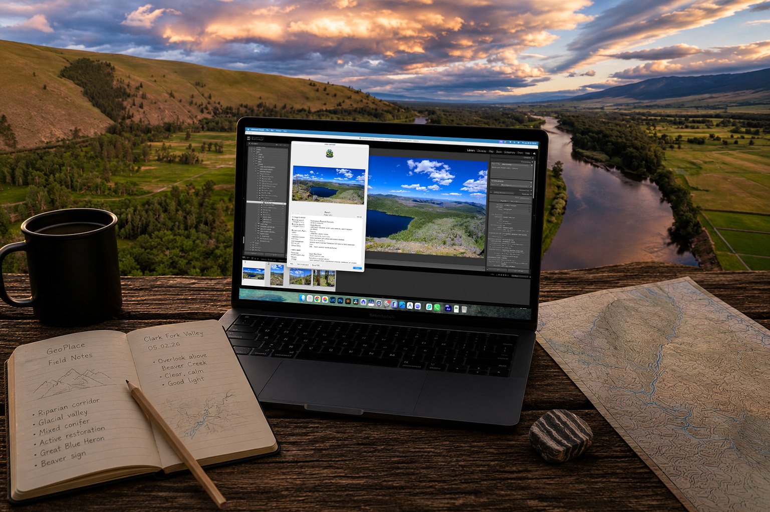
Select five geotagged photographs, choose the context you care about, and let GeoPlace resolve the natural place around them. It writes consistent, searchable metadata without forcing you out of Lightroom.
The result is a catalog you can search by refuge, park, watershed, habitat, ecological region, land designation, geology, water context, or repeat field location—not just by folder, filename, or memory.
Five photos. Ten minutes.
Start with a small selection, inspect the resolved place context in Lightroom, then repeat the same workflow on a real shoot or past trip.
Choose a selection, set clustering precision, and optionally add photos to collections.
Control location, land, water, ecology, habitat, climate, conservation, fire, soil, and geology lookups.
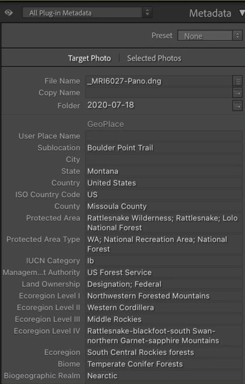
Store structured fields directly in Lightroom for future filtering, reporting, and export.
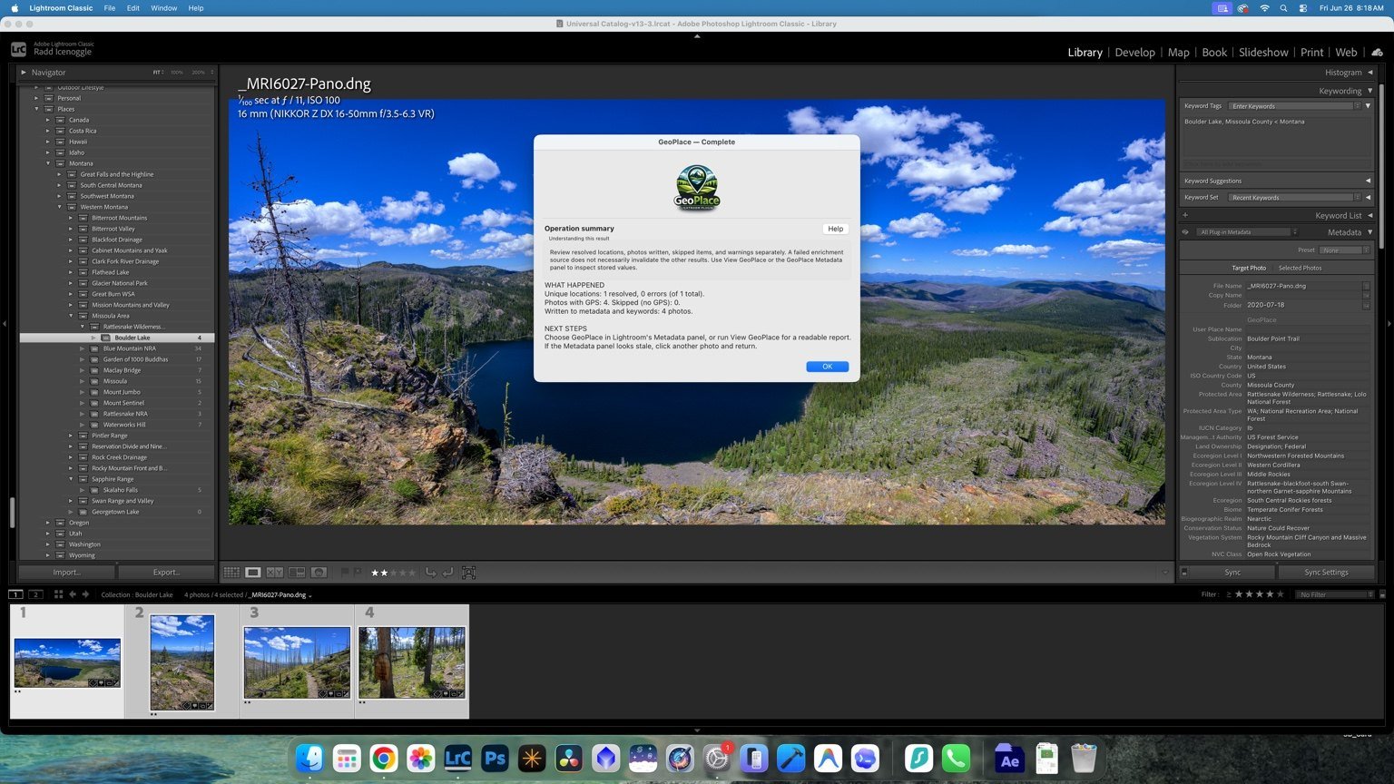
See resolved locations, written photos, skipped items, warnings, and the next available actions.
Readable reports
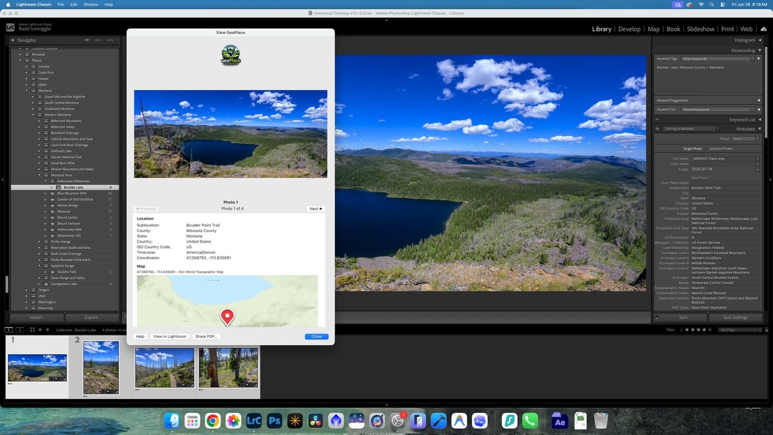
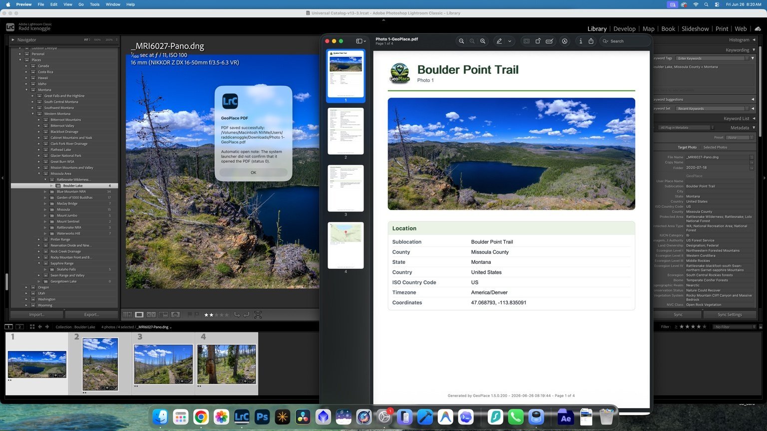
View enriched photographs in a clean report with image, location, ecology, habitat, land, water, geology, and map details.
PDF export
Generate a multi-page PDF that combines photographs with structured location and environmental context. The result is suitable for project archives, client delivery, field documentation, and research records.
Search the catalog by place
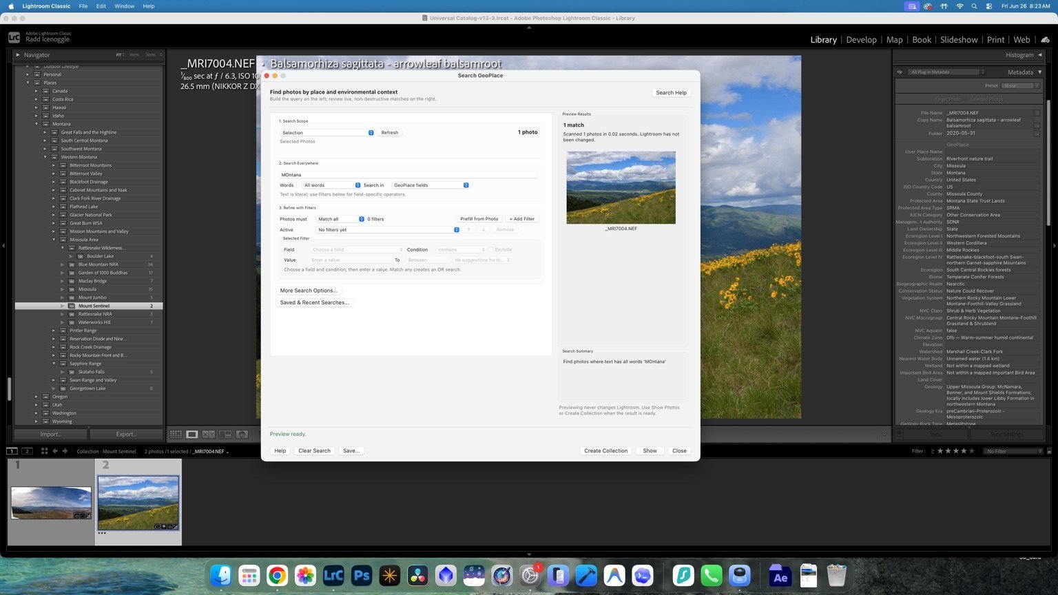
Search the current selection or the full catalog by natural-place attributes, preview matches, show the photographs immediately, save searches, or create Lightroom collections for future work.
Guided from the start
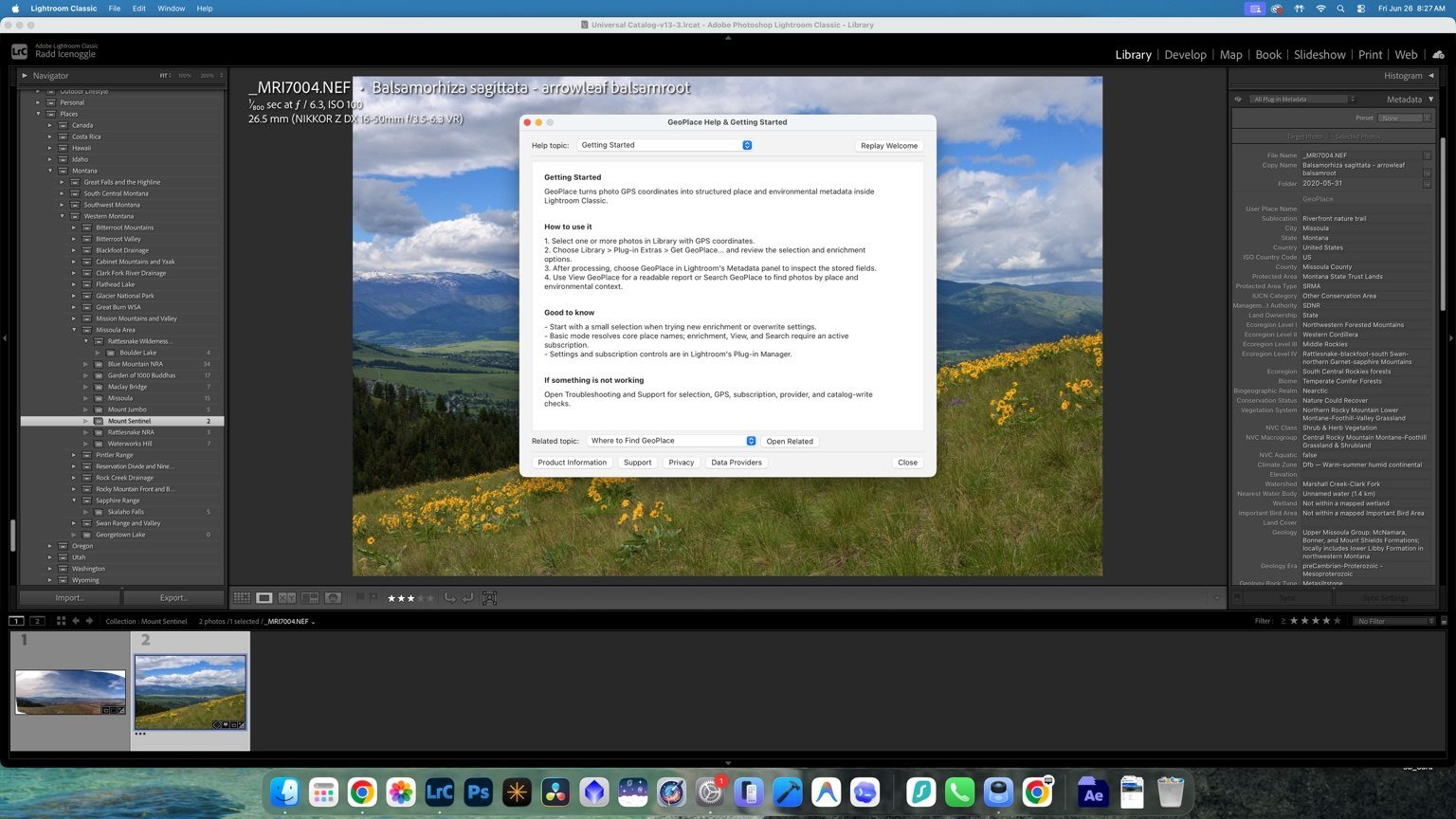
The Help Center explains the core workflow, points to related topics, and provides direct access to product information, support, privacy, and source documentation.
Built for field photography
Nature and wildlife photographers can organize by habitat, refuge, watershed, and repeat location. Landscape and travel photographers can build consistent place hierarchies across trips and regions. Naturalists, educators, and conservation communicators can add ecological context without building a GIS workflow.
Find photographs by habitat, refuge, protected area, water, ecoregion, and repeat field location.
Build a repeatable geographic hierarchy across trips, regions, watersheds, elevations, and collections.
Connect field photographs with source-aware ecological and geographic context without a separate GIS project.
Give GeoPlace five reliable geotagged photos and ten minutes, then inspect the result inside Lightroom.
Start with a real shoot
See the first useful result in Lightroom, then use enrichment, View, Search, reports, and PDF export on a real shoot or past trip.